Here we examine change over time for an area in Florida Bay with the intent of identifying change in seagrass coverage.
Two regions of interest were identified. The first is an area of seagrass coverage in Florida Bay. The second is an area of nearby deep water.
This GEE script was used to extract spectral values over time from harmonized spectral imagery. A cloud mask was applied using the CloudScore+ product. The spectral bands were normalized relative to the average of all bands. Roughly 2300 individual images were composited using a mean into a set of ~650 daily images.
The data is available in this gSheet.
The Submerged Seagrasses Identification Index 1 was calculated and visualized with a center-adjusted moving average with window size 10.
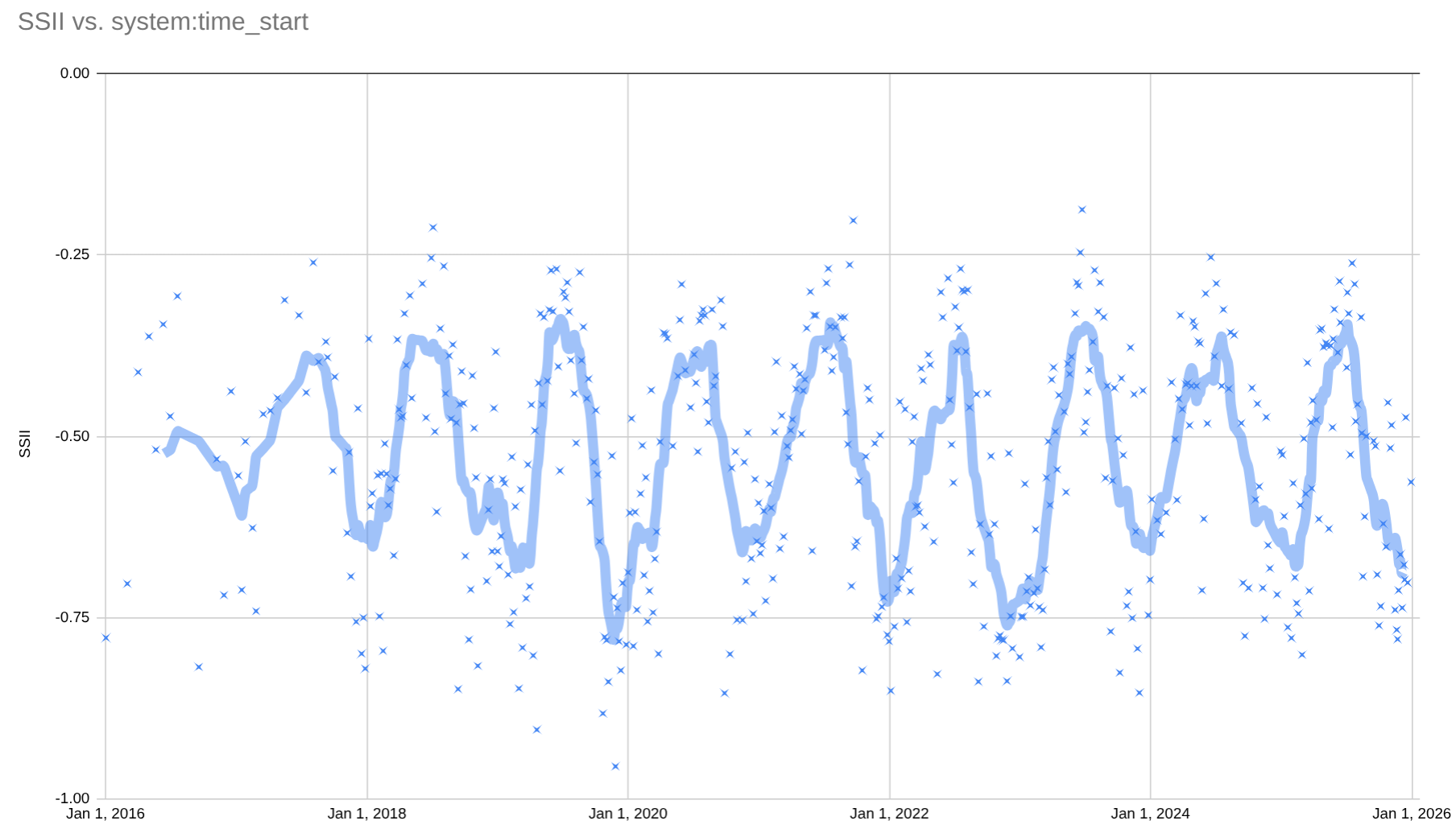
The seasonal signal is clear, however, a seasonal signal is also clear in a time series extracted from the nearby deep water area. Although this image product is adjusted for atmospheric and sun angle effects, some seasonal signal remains.
An adjusted SSII was computed to remove seasonal affects that are not related to seagrass growth itself. The same extraction was performed for the FL-Bay area and the nearby area of deep water. The SSII was computed for both regions. The deep water SSII was subtracted from the FL Bay SSII. The remaining signal is an indication of change that is independent of remote sensing changes in the larger region.

In this series the expected seasonality is still apparent. Seagrass coverage is expected to decrease in the winter and increase in the summer. The summer maximums are stable when compared to the winter minimums, which show more variablity.
The winters of 2022 and 2023 stand out as seasons of unusually low SSII. A potential cause of this anomaly could not be identified.
Footnotes
https://pubmed.ncbi.nlm.nih.gov/36682175/↩︎